WEAP In Action
Explore real-world projects powered by WEAP
The most important gain is I think the improvement of collective knowledge, understanding of water resource uses, infrastructure, management and allocation today. WEAP now offers us the opportunity to concretely experience the effects of climate change on the Durance river and to test adaptation levers. In order to collectively make the best decisions and guide public policies.
Pascal Dumoulin Syndicat Mixte d'Aménagement de la Vallée de la Durance (SMAVD) FranceWEAP has become a key tool to develop my research and I also include it in my teaching as a very user friendly tool to understand the dependencies between water resources systems components.
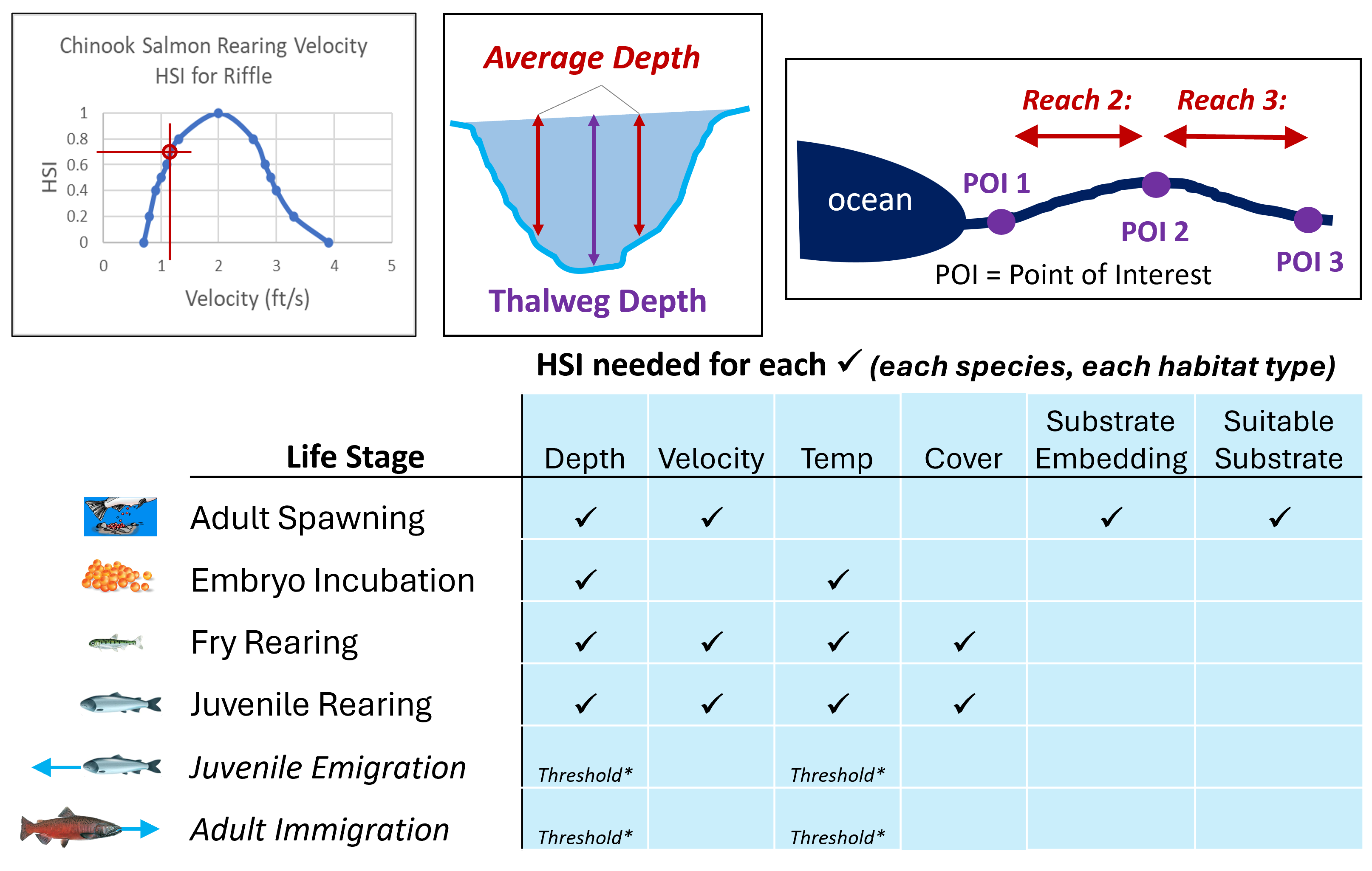
Dr. Andrea Momblanch Benavent Cranfield Water Science Institute, Faculty of Engineering and Applied Sciences United KingdomI've seen WEAP be most effective in a recent effort by Valley Water to evaluate proposed reservoir operating rules in three main watersheds in our area that are intended to mainly benefit anadromous fish in in our local streams while balancing our water supply needs.
Eric Olson Santa Clara Valley Water District USAWEAP has been immensely useful in meeting the mission of the California Water Plan. Having an integrated, physics-based, high-level model that can reliably calculate important change factors has allowed us to efficiently examine future conditions.
Paul Shipman California Department of Water Resources, Division of Planning USAHighlights
Discover the core features that make WEAP a powerful tool for water resources planning and decision support


